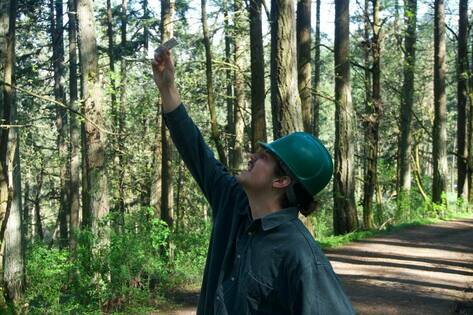
A team member determining the foliage transparency of a tree.
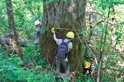
Measuring the DBH of a tree
|
The team followed a protocol developed by Emily Steel of Eugene Parks and Open Space department. All trees with a diameter at breast height (DBH) of 36 inches or greater were evaluated within the 34 management units and mapped using GPS units. The evaluation consisted of determining wildlife use, tree canopy ratio to trunk, diameter, canopy density, foliage transparency, and documenting the presence of insects and fungal pathogens. Trees with a DBH between 20 to 35 inches were recorded and mapped using GPS units; however, no evaluation took place. With data on these trees we aim to help improve the understanding of tree distribution and health within the forest. By analyzing individual trees, the team was able to gain a better understanding of the current overall health of Hendricks Park by documenting characteristics of degradation within the units.
Photopoints were created that were representative of each plot and its characteristics so that future researchers can return to for future analysis. Photos taken in directions of North, East, South, and West from one spot will be used for each management plot. These photo points are intended to be replicated for years to come to show ecological succession. Below is the Hendricks Forest Management Plan developed in 1999 which is what the project is based on: |
